Khon Kaen Temple Land Dispute Escalates as 1985 Images Renew Fight Over Ownership
Historical imagery shows Wat Pa Adulyaram’s site was heavily forested four decades ago, while a group asserting ownership has now blocked an entrance and ordered property to be removed within 15 days.
A decades-long dispute over the land occupied by Wat Pa Adulyaram in Khon Kaen has escalated again after people asserting private ownership blocked one of the temple’s entrances and ordered structures and other property to be removed, while newly revisited historical imagery has added another layer to the argument over how the site developed.
The temple, located near Khon Kaen University in a valuable urban area, maintains that much of the land was given for religious use decades ago.
Members of the original landowner’s family dispute that account and continue to assert rights over the property.
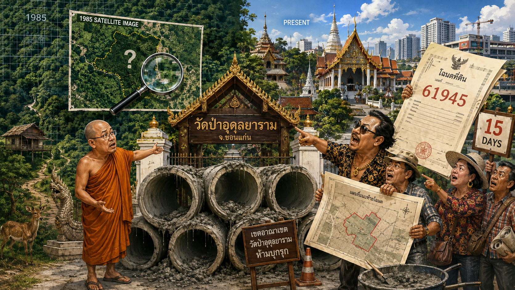
Historical Google Earth imagery reviewed on August 17 shows that in 1985 the area now occupied by the temple was still dominated by dense vegetation and appeared largely green from above.
The images are not detailed enough to establish how many religious structures, if any, were present beneath the tree cover at that time.
They therefore provide useful evidence about the physical condition of the site but do not settle the central legal question: who owned the land and what rights, if any, were transferred to the temple.
The latest confrontation began on August 10, 2026, when a group of people arrived at the temple’s entrance on Kalapaphruek Road and placed large concrete drainage pipes across the access point.
Concrete was poured into the pipes, leaving the entrance effectively blocked.
Signs were then erected stating that the land was privately owned under title deed number 61945 and warning people not to enter or use the property without permission.
A separate notice ordered buildings and other assets to be removed within 15 days and warned that civil and criminal proceedings could follow if the demand was ignored.
A monk at the temple said the obstruction prevented normal access and described an argument between temple residents and members of the group during the operation.
The people who placed the barriers were acting on the position that the temple had occupied privately owned land for more than 30 years.
That assertion remains part of a contested ownership dispute rather than a final determination of the temple’s legal rights.
The disagreement reaches back decades.
The temple’s abbot has said that he arrived at the site in 1990, when it was still functioning as a monastic retreat, and that landowner Heang Phimsri subsequently gave approximately 21 rai of land for the establishment of a temple.
Wat Pa Adulyaram was formally registered as a temple in 1998. The temple says government procedures were followed and that its occupation and development of the property were based on the landowner’s decision to dedicate the land to religious use.
The landowner’s family presents a sharply different account.
Estate administrator Buakhai Sorasamut has said that Heang discussed giving only about six rai for a temple and that the transfer was never legally completed before his death in 1991. She has produced title documents that she says demonstrate the family’s ownership and has accused the temple of occupying substantially more land than was ever intended for religious use.
Those accusations are disputed by the temple and should not be treated as established findings of wrongdoing.
The disagreement has generated repeated litigation.
In 2004, the landowner’s family began proceedings seeking the return of two areas associated with the temple, including a parcel of about 21 rai, three ngan and 61 square wah and another area of roughly five rai.
The temple prevailed in the earlier proceedings through the lower courts, and the Supreme Court in July 2012 declined to disturb the previous rulings and removed the case from its docket.
The dispute nevertheless continued through a separate legal route.
A later action named the Khon Kaen land authorities, Khon Kaen municipality and Wat Pa Adulyaram as defendants and sought remedies connected with land rights, registration and ownership.
A Civil Court dismissed that action at first instance, after which the claimant appealed.
Publicly available accounts of the dispute have not established that the later proceedings produced a final ruling transferring the contested land away from either side before the confrontation in August 2026.
The historical imagery now being examined is potentially relevant because the competing narratives depend partly on when the religious community occupied and developed different parts of the property.
The 1985 view appears to show extensive forest cover several years before the current abbot says he arrived.
Later occupation, buildings, paths and other features can help reconstruct the site’s physical history.
But tree cover visible from satellite imagery cannot establish whether an owner donated land, whether a transfer satisfied legal requirements or which title document governs a particular boundary.
The dispute therefore involves several different questions that should not be collapsed into one.
The physical history of the site can be examined through old imagery and witnesses.
The history of the temple can be examined through registration and religious records.
Ownership depends on title documents, transactions, inheritance records and court decisions.
Long possession of land and the construction of religious buildings may be important evidence, but they do not automatically resolve every question surrounding title.
The latest attempt to restrict access has transformed a long-running courtroom and documentary dispute into a physical confrontation at the temple itself.
The notice posted on August 10 gives occupants 15 days to remove structures and property from the area claimed under title deed number 61945, placing the next immediate deadline in late August.
Any attempt to remove buildings or alter possession of the site is therefore likely to intensify scrutiny of the title documents, earlier court rulings and the precise boundaries of the land claimed by both sides.
The temple, located near Khon Kaen University in a valuable urban area, maintains that much of the land was given for religious use decades ago.
Members of the original landowner’s family dispute that account and continue to assert rights over the property.
Historical Google Earth imagery reviewed on August 17 shows that in 1985 the area now occupied by the temple was still dominated by dense vegetation and appeared largely green from above.
The images are not detailed enough to establish how many religious structures, if any, were present beneath the tree cover at that time.
They therefore provide useful evidence about the physical condition of the site but do not settle the central legal question: who owned the land and what rights, if any, were transferred to the temple.
The latest confrontation began on August 10, 2026, when a group of people arrived at the temple’s entrance on Kalapaphruek Road and placed large concrete drainage pipes across the access point.
Concrete was poured into the pipes, leaving the entrance effectively blocked.
Signs were then erected stating that the land was privately owned under title deed number 61945 and warning people not to enter or use the property without permission.
A separate notice ordered buildings and other assets to be removed within 15 days and warned that civil and criminal proceedings could follow if the demand was ignored.
A monk at the temple said the obstruction prevented normal access and described an argument between temple residents and members of the group during the operation.
The people who placed the barriers were acting on the position that the temple had occupied privately owned land for more than 30 years.
That assertion remains part of a contested ownership dispute rather than a final determination of the temple’s legal rights.
The disagreement reaches back decades.
The temple’s abbot has said that he arrived at the site in 1990, when it was still functioning as a monastic retreat, and that landowner Heang Phimsri subsequently gave approximately 21 rai of land for the establishment of a temple.
Wat Pa Adulyaram was formally registered as a temple in 1998. The temple says government procedures were followed and that its occupation and development of the property were based on the landowner’s decision to dedicate the land to religious use.
The landowner’s family presents a sharply different account.
Estate administrator Buakhai Sorasamut has said that Heang discussed giving only about six rai for a temple and that the transfer was never legally completed before his death in 1991. She has produced title documents that she says demonstrate the family’s ownership and has accused the temple of occupying substantially more land than was ever intended for religious use.
Those accusations are disputed by the temple and should not be treated as established findings of wrongdoing.
The disagreement has generated repeated litigation.
In 2004, the landowner’s family began proceedings seeking the return of two areas associated with the temple, including a parcel of about 21 rai, three ngan and 61 square wah and another area of roughly five rai.
The temple prevailed in the earlier proceedings through the lower courts, and the Supreme Court in July 2012 declined to disturb the previous rulings and removed the case from its docket.
The dispute nevertheless continued through a separate legal route.
A later action named the Khon Kaen land authorities, Khon Kaen municipality and Wat Pa Adulyaram as defendants and sought remedies connected with land rights, registration and ownership.
A Civil Court dismissed that action at first instance, after which the claimant appealed.
Publicly available accounts of the dispute have not established that the later proceedings produced a final ruling transferring the contested land away from either side before the confrontation in August 2026.
The historical imagery now being examined is potentially relevant because the competing narratives depend partly on when the religious community occupied and developed different parts of the property.
The 1985 view appears to show extensive forest cover several years before the current abbot says he arrived.
Later occupation, buildings, paths and other features can help reconstruct the site’s physical history.
But tree cover visible from satellite imagery cannot establish whether an owner donated land, whether a transfer satisfied legal requirements or which title document governs a particular boundary.
The dispute therefore involves several different questions that should not be collapsed into one.
The physical history of the site can be examined through old imagery and witnesses.
The history of the temple can be examined through registration and religious records.
Ownership depends on title documents, transactions, inheritance records and court decisions.
Long possession of land and the construction of religious buildings may be important evidence, but they do not automatically resolve every question surrounding title.
The latest attempt to restrict access has transformed a long-running courtroom and documentary dispute into a physical confrontation at the temple itself.
The notice posted on August 10 gives occupants 15 days to remove structures and property from the area claimed under title deed number 61945, placing the next immediate deadline in late August.
Any attempt to remove buildings or alter possession of the site is therefore likely to intensify scrutiny of the title documents, earlier court rulings and the precise boundaries of the land claimed by both sides.